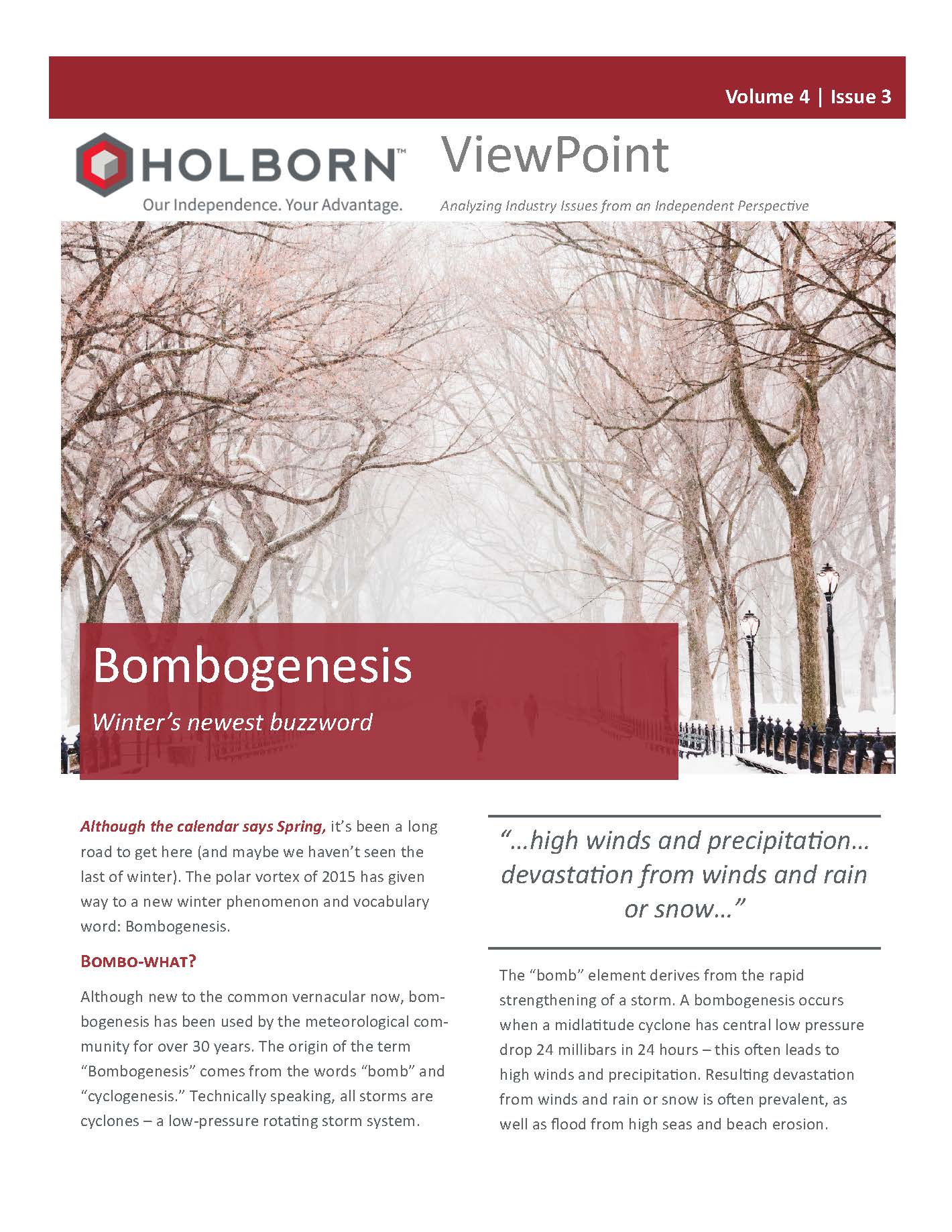

Although the calendar says Spring, it’s been a long road to get here (and maybe we haven’t seen the last of winter). The polar vortex of 2015 has given way to a new winter phenomenon and vocabulary word: Bombogenesis.
Bombo-what?
Although new to the common vernacular now, bombogenesis has been used by the meteorological community for over 30 years. The origin of the term “Bombogenesis” comes from the words “bomb” and “cyclogenesis.” Technically speaking, all storms are cyclones – a low-pressure  rotating storm system. The “bomb” element derives from the rapid strengthening of a storm. A bombogenesis occurs when a midlatitude cyclone has central low pressure drop 24 millibars in 24 hours – this often leads to high winds and precipitation. Resulting devastation from winds and rain or snow is often prevalent, as well as flood from high seas and beach erosion.
Where do these storm occur? 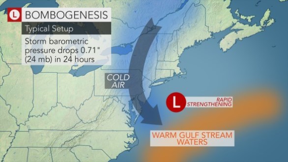
Often bombogenesis occurs over the ocean and are characterized as a large column of air spinning counterclockwise, in the Northern Hemisphere, and producing a vacuum effect. Rapidly rising air at the center of the storm is replaced by air surrounding the disruption and can draw in cold air from the north. Winds moving toward the center of the storm often leave devastation in their wake. The formation is driven by the collision of warm and cold air masses. The faster the air rises and cools, the heavier the precipitation.
Most commonly, bombogenesis occur in the western North Atlantic, where cold air from North America mingles with warmer air over the Atlantic Ocean. These storms can also be found in the northwest and southwest Pacific, as well as the South Atlantic. It should be noted that not all bombogenesis events are winter storms, as seen below, but all meet the criteria of a decrease of 24 millibars in 24 hours.
Notable Bombogenesis Events
March 12-13, 1993 – Known as the “Storm of the Century,” at the time. The storm quickly strengthened over land at a rate of 33 millibars in 24 hours. The storm produced hurricane force winds across the Gulf and Southeastern U.S. In total, the storm affected 26 states and eastern Canada with substantial snowfall and high winds. Mount Leconte, Tennessee recorded 60 inches of snow and there was widespread power outages throughout the country.
Hurricane Charley (2004) — Charley hit Florida as a Category 4 hurricane, having had its pressure drop 23 millibars in just 5 hours. The storm’s highest sustained winds were 150 mph and caused approximately $9.3Bn insured losses (2016 dollars).
Hurricane Wilma (2005) — Wilma produced $12.5Bn insured losses in 2016 dollars, according to the Insurance Information Institute (III). Wilma dropped 97 millibars in 24 hours, a record then and now. The storm had 185mph sustained winds and made U.S. landfall as a Category 3 storm on Cape Romero, Florida with 120 mph winds.
Winter Storm Juno (Jan 26-27, 2015) — “The Blizzard of 2015” brought 4—5 feet of storm surge on Cape Cod and Nantucket, as well as hurricane strength winds of 80 mph. Wave height in the Gulf of Maine reached 30 to 40 feet. The New England region also saw up to 36 inches of snow. As it developed, the blizzard’s central pressure dropped more than one millibar per hour.
Winter Storm Grayson (Jan 3-8, 2018) — Northeastern U.S. affected when the central pressure dropped 59 millibars in 24 hours, setting a record for the Western Atlantic Ocean, since 1976. Over the course of the storm, Grayson dropped over a foot of snow from Virginia to Maine, with some areas seeing much larger amounts. Coastal flooding was also severe, as well as wind gusts up to 50mph at JFK Airport (NYC) and 70mph on Cape Cod.
Modeling Winter Storm
Most of the major model vendors offer a product to model severe winter storms. These models generally produce losses due to snowfall depth (weight/loads due to large amounts of snow), ice and freeze (ice dams, fallen trees, burst pipes), and strong winds.
In order to generate modeled events, model vendors turn to the power of Numeric al Weather Prediction (NWP) technology. NWP uses the mathematics that describe the behavior of our atmosphere in order to simulate weather front scenarios.
Each model vendor has their own methodology, but many use NWP output in conjunction with statistical modeling of real world historical events.
Although storms undergoing bombogenesis are not explicitly modeled in any of these cat models, all base their stochastic event sets on extratropical or mid-latitude cyclones, some of which undergo a rapid intensification.
Most model vendors include historical events in their winter storm catalogs, including events that have undergone bombogenesis, such as the March blizzard of 1993.
The rapid intensification that defines bombogenesis typically occurs over ocean waters and before landfall. When modeling winter storm, only parameters at the time of landfall affect loss estimates—snowfall, duration of freezing temperatures, and presence of ice, etc. Therefore, whether a winter storm in the model’s catalogue underwent bombogenesis, or not, is irrelevant for modeling purposes. The fact that these powerful events can develop in a short time underscores the need to monitor forecasts.
Like other perils, winter storm models have their weaknesses in converting hazards to loss dollars. The complexity of the freeze/thaw/refreeze cycle that causes many losses remains a challenge for vendors to accurately represent in their models today. Therefore, it is important to understand and prepare for loss potential on a practical, and not only stochastic, basis.
Conclusion
Holborn continues to monitor the evolution of winter storm modeling. As no model is 100% accurate, Holborn uses deterministic models, geospatial analysis, client-specific historical experience, and industry figures to help assess risk potential.
Like all risk, it is important to understand the accumulation of exposure, impact on the balance sheet, and how to manage risk—via reinsurance or underwriting, as part of Enterprise Risk Management and overall risk assessment.
Holborn is here to do just that.
The full report is available for download here:
ViewPoint_Bombogenisis_v4i3