WeatherGuidance Significant Event Alert —
A major flood and flash flood event is about to get underway across portions of the Southeastern U.S., generally within the area outlined in red on the above image. The potential exists for this to become an historic and/or catastrophic event in some parts of this region. At this time, we expect the hardest hit areas to be across large portions of the Carolinas, especially South Carolina and southern/eastern North Carolina.
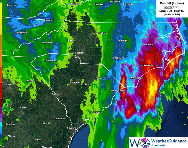
As many as 4-5 inches of rain have already fallen so far today across extreme eastern South Carolina and portions of eastern North Carolina, as shown in bright orange/yellow on the image below:

Rainfall is increasing in coverage and intensity across the region at this hour, while at the same time developing further to the West. This will result in locally heavy rainfall covering most of the remainder of South Carolina and into central and eastern North Carolina very soon this evening.
Widespread additional rainfall of 5-10 inches with locally higher amounts in excess of 10 inches are expected across much of this region starting this evening and ending later this weekend.
The heaviest of the additional rain is expected to be focused across much of South Carolina into southern North Carolina, where in excess of 10-15 inches of additional rainfall is likely, potentially on a widespread basis:

With grounds already saturated and/or quickly becoming so across this region, the stage is set for a widespread, historic and potentially catastrophic flooding event. While the brunt of the additional heavy rainfall will occur from this evening into Saturday, flooding of rivers, streams and low lying areas will likely continue long after the rain stops falling – extending into at least early next week.
We will continue to monitor this situation very closely and issue updates as conditions warrant.

